
The Art of Travel
At Walking Connection, we practice the art of travel—well-defined, deeply personal, and masterfully designed for independent travelers.
We design experiences with intention—for the curious, the bold, and the willing. It’s about engaging in exciting, meaningful, or downright unusual experiences—sometimes, all three.
We specialize in the craft of immersive, independent travel. It isn’t a spectator sport. It’s participatory by design. It's the act of doing—of walking the trail, tasting the unfamiliar, navigating the unknown, with us leading the way.
We curate journeys that balance freedom with structure. We deliver adventure—refined, purposeful, and beautifully executed. It’s not ziplining and GoPros. It’s quiet epiphanies, rare access, elegant yet purposeful accommodations, and the deep joy of discovering something meaningful.
So, what is the true definition of Artful Travel?
It lives somewhere between your eyes, your mind, and your heart. It's deeply personal, and it’s shaped by the way you engage with the world. We know the way!


Travel Reimagined | Custom Travel, Redefined
You might begin with a noir palette or greyscale vision—a rough outline of where you want to go and a few dreamlike fragments of what you hope to see or do once you arrive. Or maybe your imagination holds a blurred image of the globe, spinning with endless possibilities, yet lacking the clarity of a singular, resonant destination.
That’s where we come in.
Like stepping into Oz, Walking Connection transforms your monochrome musings into a panorama of vibrant color. We don’t just plan trips—we breathe life into them. We take those hazy wanderlust visions and refine them into high-definition, soul-stirring travel experiences. Ones that don’t just check boxes on a list but live in your memory, vividly and forever.
With us, every detail is intentional. Every step has been taken. Every partner has been carefully chosen. Every possibility has been considered. We know the way.


THE ART OF PURPOSEFUL DISCOVERY
_______________


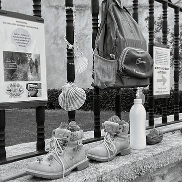
SAVOR THE SOUL OF CULTURE
_______________

UNDERSTAND
ITS BELIEFS
_______________


STORIES ETCHED IN
SOIL & STONE
_______________
INSPIRATION
aaaa_edited.jpg)

aaaa_edited.jpg)


GETTING TO KNOW YOU
_______________


PARTNER WITH US
_______________
SIGNATURE CONNECTIONS


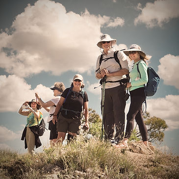
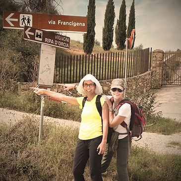
Signature Adventures
At Walking Connection, we don’t sell vacations—we design transformative journeys, tailored with precision and intention for independent and solo travelers who crave more than the ordinary.
Each itinerary is a bespoke creation, artfully curated to reflect your unique travel style, interests, and rhythms. Whether it’s a secluded mountain retreat, a private culinary immersion, or a guided walk through history’s forgotten paths, every moment is designed to feel effortless, exclusive, and deeply personal.
Our Signature Adventures -- We partner only with those who share our obsession for detail and our commitment to excellence—local guides, boutique properties, and immersive experiences that deliver authenticity and adventure. We know them intimately. They know us.
This is travel elevated: customized to your pace, grounded in connection, and charged with the spirit of exploration.
You dream it. We craft it. Then, we're by your side from the first spark to the last sunset.
Your journey begins the moment you say yes. Let’s design something extraordinary—just for you.
